

Once the United States purchased the land covered in the Louisiana Purchase, pioneer-minded people started moving west. But, of course, in some places others were already living in these areas and didn’t welcome these people trying to take their land. Conflicts happened, and the military was called in. This post covers the conflicts that started before this large land purchase and continues to the years before the Civil War. If you love history, you’ll love this post. I’ll go in chronological order, which means that I’ll have to move you around the country because the conflicts happened everywhere.

history of Fort Leavenworth
Fort Leavenworth, established in 1827, is the oldest army post in continuous operation west of the Missouri River (and west of Kansas City). In its early years, it was the army’s chief base of operations on the Central Plains and furnished troops and supplies for military operations as far away as the Pacific Coast.
Troops stationed here were tasked with maintaining peace on the frontier and protecting trade on the newly established Santa Fe Trail. When the Oregon-California Trail opened in the 1840s, travelers on that trail also received protection.

When war with Mexico started in 1846, the Army of the West organized at the Fort for its epic journey to California and northern Mexico.
When Kansas achieved territorial status in 1854, the first office of the territorial governor was at the fort.
In 1881, General Sherman [from the Civil War time] established a school that evolved into the Command and General Staff College, the highest ranked school in the army educational system. One notable student, Major Dwight D. Eisenhower, graduated in 1926 with highest honors in his class.
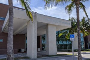
the fort today
Instead of building the Fort on the west side of the Missouri River itself, it was built on the cliff overlooking the river so flooding wouldn’t be an issue. Pretty smart.


prior to the expedition

Canada was ceded to the British at the conclusion of the French and Indian War in 1764. The Mississippi-Missouri River Valley was later sold as part of the Louisiana Purchase to the U.S. in 1804.

The U.S. and Spain had different opinions about the land included in the Louisiana Purchase. The U.S. understood that the purchase included all the lands drained by the Mississippi and Missouri Rivers, with the Red River that flows into the Gulf as its southern boundary.
Spain asserted that the purchase only included territory roughly defined by present day Louisiana, Arkansas, and a part of Missouri. Spain also worried that Lewis and Clark might discover that the Missouri River turned south and reached deep into their territory. [This didn’t happen, and Spain never found the expedition in their land.]
1819 – steamboats on western waters
The Yellowstone Expedition was an expedition to the American frontier in 1819 and 1820 authorized by United States Secretary of War John C. Calhoun. His goal was to establish a military fort or outpost at the mouth of the Yellowstone River in present-day North Dakota. (Wikipedia) This location is near Williston in northwest North Dakota, where we’ll be soon on our trip.

The plan was to use steamboats as a form of transportation to get to this place on the Missouri River. These machines changed everything. They were huge and could move people and cargo across the country in great clouds of smoke on highways of water.

The first 6 steamboats of the expedition were probably Major Stephen Long’s idea. His team of scientists and their equipment traveled on the aptly named Western Engineer.
Secretary of War Calhoun told Long that his objective was “To acquire as thorough and accurate knowledge as may be profitable, a portion of our country, which is daily becoming more interesting but is as yet impefectly known. With this view, you will permit nothing worthy of notice, to escape your attention.”
We’ll probably learn more about this expedition using steamboats when we’re in Williston, North Dakota, but it’ll be interesting to see if the Missouri River can be navigated more easily than what we showed you in part 11 with the steamboats Arabia and, in another post from a number of years ago, the Bertrand.
1821 Santa Fe Trail
The Santa Fe Trail was a 19th-century route connecting Franklin, Missouri, to Santa Fe, New Mexico, established in 1821 by William Becknell. It served as a vital commercial highway until the arrival of the railroad in 1880, playing a significant role in America’s westward expansion. (Wikipedia)
Mexico gained independence from Spain in 1821, opening the door for trade with Mexico. William Becknell, a War of 1812 veteran, seized the opportunity and journeyed to Santa Fe, New Mexico. Going back and forth numerous times, his path became an established trade route known as the Santa Fe Trail as the route supplied Mexico with manufactured goods produced in the U.S.


Early on, without military escorts, the wagon trains were increasingly at risk of hostile Indian attacks, and so they petitioned the U.S. Government for help, which came from Fort Leavenworth in 1827. It became apparent that the need for a mounted force was required to protect commerce and travel, and so the Regiment of Dragoons was authorized in 1833. These were the first horse-soldiers in the U.S. since the War of 1812.

1836 Oregon Trail
The Oregon Trail was laid by fur traders and trappers from about 1811 to 1840 and was initially only passable on foot or horseback. By 1836, when the first migrant wagon train was organized in Independence, Missouri, [east of Kansas City, Missouri] a wagon trail had been cleared to Fort Hall, Idaho. Wagon trails were cleared increasingly farther west and eventually reached the Willamette Valley in Oregon, at which point what came to be called the Oregon Trail was complete.
Hundreds of thousands of pioneers in the mid-1800s used this 2000-mile emigration route to move west in search for a new life. Travelers on the trail relied on animals, such as horses and mules, to pull their wagons starting in 1836. The downside was that these animals were high maintenance and needed plenty of grain and attention. Mules were stronger than horses and surer footed than other animals when it came to climbing mountains and hills, but they also tended to be frequently stolen by locals. Oxen were useful for pulling large, heavy loads due to their strength. They could forage on natural grasses, which made them low maintenance. Oxen also moved slower than horses or mules, so they were used more for shipping goods than for quick movements.

In 1848, the Donation of Land Act offered married settlers 320 acres of free land and single settlers 160 acres. Over 50,000 people settled in Oregon between 1840-1860.
In 1849, mounted infantrymen known as Dragoons left Fort Leavenworth, KS, in May of that year to begin offering security on the trails. They traveled with wagon trains to protect civilians and merchants from hostile local populations as they traveled west. In 1861, the regiment was re-designated and became the 3rd Calvary.

John C. Fremont – background

Fremont lived life on a borderline: he was always an insider and an outsider, an illegitimate child who made his way into America’s powerful elite. While not a West Point graduate, he rose to prominence in the Army. He was loved by his men and the public, but suffered the humiliation of a court martial as a result of his actions in California during the Mexican War. Fremont was the first Republican candidate for President.

Early on the voyage, he met the famed explorer, Joseph Nicollet and became his protege. When Nicollet’s health failed, Fremont was selected to take his place as leader of the 1842 expedition to map the Oregon Trail.
Other assignments followed, and Fremont, now a captain, burnished his image as “The Pathfinder” for American destiny.
1843 – 1844 when Fremont saw the Great Basin
On his 2nd expedition into the West, Fremont made an overland circuit from the Front Range of the Rockies to the Columbia River, to California, and back to Utah.

“Great Basin.”
After Fremont reached Fort Vancouver on the Columbia River in November 1843, he moved down the line of volcanoes in central Oregon, edging toward California and Mexican sovereignty (he did this by breaking orders, taking a route in the opposite direction, and penetrating deep into Mexican territory). On a snowy winter day, a slice of light appeared before them on the eastern horizon. Standing on the edge of a great escarpment in eastern Oregon, Fremont saw that he was at the western edge of a tremendous natural depression at the interior of the continent.
The following spring and hundreds of miles later, Fremont confirmed his moment of good seeing: he called it “the Great Basin.”

[A few years ago we drove along Hwy. 50 in Nevada through this Great Basin and saw what Fremont saw years before. You can click on this Great Basin link to read what we learned about it. This drive was one of the most amazing drives we’ve enjoyed.]
1846-1848 border war with Mexico
In 1845 when Texas joined the Union, a dispute erupted into war with Mexico because the 2 countries claimed different rivers as the southern border. U.S troops were sent to occupy the disputed territory. Though outnumbered 4-1, the U.S. forces were able to defeat the Mexicans and obtain their Rio Grande boundary, plus the territory that would become California, Nevada, Utah, Colorado, Arizona, and New Mexico.

Four major campaigns decided the war with Mexico. The 1848 treaty with Mexico called for commissioners and surveyors from both nations to fix and mark the border.

(I wonder if this is the Mr. Emory that the university in Atlanta was named after.)

The 2 countries settled on a line from the Rio Grande to the Gila River then west to the Pacific. The Army was ordered out to help mark a new frontier.
1848 The Plains War
With the end of the Mexico War, large numbers of Americans headed west, New territories had been annexed and gold had been discovered in California, causing conflict between the Indian tribes of the Great Plains and the U.S. Army. The Plains tribes primarily included the Sioux, Cheyenne, Kiowa, Comanche, and Arapaho. The Army focused on protecting major travel routes where most of the Indian attacks occurred. Indian hostility and resentment grew stronger as the use of these routes through their lands increased.
In the south, Kiowa, Comanche and Cheyenne threatened the commerce with Santa Fe and raided deep into Texas. In the north, the Sioux threatened the Oregon Trail.


1850 The Mountain Wars
As early as the 1850s, missionaries, prospectors, farmers, and ranchers began moving toward the mountainous area of the Northwest, entering territories of various tribes. Tensions grew as the number of white settlers increased and consumed, without restriction, the natural resources that the Indians relied on for their survival.

Skirmishes started escalating, eventually breaking into open warfare. The fighting ended with peace treaties between the Indians and the U.S. government, under which the tribes were to cede their lands and move to the reservations.


1853 the railroad
The outlines of the continental United States (minus Alaska) had been drawn. The first phase of the great struggle for the West was over. By the 1850s, turnpikes (toll-roads), steamboat lines, canals, railroads, and telegraph wires reached across much of the nation like a giant net. These media sources were a powerful message: a new phase in historical geography had began. Nations would span continents. The world had grown smaller.

Finally, in 1853, Congress authorized surveys and commissioned the Army Topographical Engineers to assess 5 possible routes. The move was calculated to skirt sectional politics.
This was a classic fusion of 19th century American ideals—answer the question “scientifically.” The thought was that the scientific method would reveal the solution that Nature, or Providence, had in store. (We’ll have more information about the transcontinental railroad in part 16.)
[If you want to learn more about the Army Topographical Engineers and what they did in the 1800s, please check out this Wikipedia link.]
1854 Bleeding Kansas
Kansas was organized as a territory on May 30, 1854. The same act provided for popular sovereignty, which was the subject of the Lincoln-Douglas debates. Popular sovereignty allowed residents to decide for themselves if their territory (Kansas in this case) would enter the Union as a free or slave state.

As popular sovereignty evolved into open violence, “Bleeding Kansas” became a battle ground in which the Army could do very little to prevent civil disturbances. On the eve of the Civil War, the Free-States prevailed, and Kansas entered the Union as a Free State.
women of the frontier
Women took active roles in America’s westward expansion. Pioneering was an equalizer; everyone participated in tasks that may have traditionally been performed by the opposite sex.


Working-class women wore simpler, more practical clothing.
1900-1915 Fort Leavenworth
As we were walking out of this amazing museum, we saw this strange display.


Whenever we’re on military campgrounds, we appreciate hearing some of the “bungle calls” over the public address systems.
We’ve finished our time in Kansas City (both in Missouri and across the river in Kansas in this post). Now on to Omaha and the the importance of the bluffs on the other side of the river at Council Bluffs, Iowa.
2 Comments
Leave your reply.