

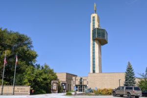
We will be learning so much more about the Lewis & Clark expedition as we continue on our trip, but one of my questions is: What happened to Lewis and to Clark when they returned? This post answers this question. It came when we took a day trip to Fort Osage along the Missouri River that’s northeast of Kansas City. As the expedition was passing by this area in 1804, Clark is said to have thought that it would be a good place for a fort to be a buffer between the Indians and the people wanting to go west and explore the land that the Louisiana Purchase had opened up.

After Clark’s return from the expedition, he was appointed as Indian Agent for the territory in 1807 and returned to the bluffs in this area in 1808 with the St. Charles Dragoons and started construction on Fort Osage.


treaties
During September 1808, Clark, with the assistance of Nathan Boone, Daniel’s son, concluded a treaty with the Osage tribal leaders persuading them to cede much of their Missouri lands to the government on what Clark later admitted were shamefully inadequate terms.

He ordered the boats to be unloaded and tools to be be ready for work on the fort and other buildings. The general layout was to be a pentagon-shaped fort protected by blockhouses on 4 of its 5 corners. The factory (next post) and civilian dwellings would be guarded by a 5th blockhouse located on a point.

In 1822, Congress disbanded all the government trading houses (next post) and reassigned soldiers to other duties in the East. By 1833, no military presence was left at Fort Osage, and the civilians living in the area had stripped the stockade of its lumber leaving only ruins of what had been.

Clark, serving as an Indian Agent, proposed Fort Clark (later Fort Osage) as a trade post and negotiated a treaty that ceded Osage land east of the fort in exchange for protection and trade services.
The American presence at the treaty signing was very small, and many Osage chiefs were also absent during the signing. They later contested the treaty’s legitimacy. Lewis rescinded Clark’s version and sent fur trader Pierre Chouteau to renegotiate.

This 2nd treaty was signed on November 10, 1808, but Congress took until 1810 to ratify it.

Clark’s importance
Clark’s actions as an explorer, military officer, and government official helped open the West to vast change, both bad and good.

Following the expedition to the Pacific Ocean, Clark drew a master map of the American West based on smaller maps he’d sketched, existing maps, geographical data he and Lewis had collected, and information provided by other western travelers.
Two hundred years later geographers still marvel at the quality and accuracy of Clark’s geographic masterpiece.

Clark’s map showed that the Rocky Mountains posed a far greater barrier to western travel than anyone had previously imagined, and it also demonstrated that, contrary to popular belief, the Missouri River was not connected to the Columbia River and thus to the Pacific Ocean. When it was finally published in 1814, Clark’s map rendered all existing maps obsolete of western North America.
Clark negotiated 37 treaties with Indian tribes, far more than any other official in U.S. history. Most of those treaties called for the Indians to surrender their lands to the U.S. and move farther west.

Clark frequently showed compassion and sympathy for opposed Indian people and sought to come to their aid. His political opponents accused him of being an “Indian lover.”
William Clark, whom the Indians called “Red Headed Chief,” regularly met with visiting tribal delegations in St. Louis to conduct business. He also escorted selected Indian leaders to Washington, D.C. for meetings with the President and other U.S. officials.
Next let’s look at Fort Osage and the factory system, whatever that is.
Leave a Reply
Your email is safe with us.