

Part of the joy of this trip has been to discover places we’ve never heard of but are so glad we were able to experience. The drive from the Tetons to Ten Sleep was such a discovery. Why the name Ten Sleep? According to SI, “The term ‘Ten Sleep’ refers to the distance of ten days’ travel, or ‘sleeps,’ from major Sioux camps. Ten Sleep is situated midway between these camps, making it an important waypoint for travelers.” Now we know the meaning of this (for us) unusual name of a town.
To get to Ten Sleep, we drove east from the Tetons through the Shoshone National Forest and the Wind River Reservation to get to the town of Shoshoni. This was such a beautiful drive, but pictures from my camera just couldn’t capture what we were seeing. I’m so sorry that I can’t show you what we saw, but maybe you can take this drive at some point in the future.
At Shoshoni (where I bought some more postcards), we started driving north to the town of Thermopolis through the Wind River Canyon Scenic Byway. The 2,500 foot-deep canyon is more than I can describe. It’s oldest layers of rock date back to the Precambrian era, over 2.5 billion years ago. As we drove we kept seeing signs indicating the geological age of the rocks we were passing. I worked hard to pass Geology in college, so at least I had heard of these eras, but the details of each one were beyond my knowledge. One website called this area “A Geologic Masterpiece.”
SI describes it this way, “The canyon just before Ten Sleep from Wind River is the Wind River Canyon, which is a dramatic gorge that runs along U.S. Highway 20 between Shoshoni and Thermopolis, featuring stunning rock formations and a deep river valley. This scenic byway is known for its breathtaking views and geological significance.” Bet you want to take this drive now.
Ten Sleep
Then we drove into Ten Sleep, we thought it was the location of the town was described in the Joe Picket books by C.J. Box. Joe’s a Wyoming Game Warden who solves murders, usually without using his gun. But we later learned that these books were based on the other side of the mountain range that we’ll be driving over and that’s included in this post.

Ten Sleep is located in the Bighorn Basin in the western foothills of the Bighorn Mountains. Wikipedia tells us about this area in one of its posts, “It is known for its outdoor activities, such as rock climbing, kayaking, and rodeo, and its history as a ranching and mining community.” This area has so much more available to visitors than our pictures show.

When we realized that this town wasn’t the location we were looking for, we decided to move on to Sheridan for a longer stay at a KOA so I could get caught up on blog posts. Also, our campground was nice, but the farmer who owned the land next to it kept his cows and pigs close to the fence. (We were told that he wanted the campground to close down so his animals wouldn’t be bothered by the people, and perhaps he could buy the land the campground was on). The smell and the flies encouraged us to move on to Sheridan.
First though, we got to drive across the southern end of the Big Horn Mountains, and I do have pictures from this drive. Both Joe Picket and Walt Longmire from the Longmire books and TV series (modern day lawmen) would have spent time in these mountains. Joe would have been all over them as the Game Warden; Walt as sheriff would have probably just been on the eastern side of the Big Horns. As we were driving through the Bighorn National Forest, we kept seeing where these two characters could have been as they were chasing bad guys.
Bighorn National Forest

At this sign, we are standing at the bottom of Tensleep Canyon near the western edge of the Big Horn Mountains. These steep rocky cliffs were the native territory of the Bighorn sheep. Disease and the activities of humans and livestock have led to their eventual disappearance. However, they have been reintroduced to this forest through the efforts of the U.S. Forest Service and the Wyoming Game and Fish Department.


Tensleep Canyon
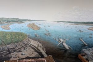
Ages ago, these mountains were deep within the Earth’s crust, and the area that is known today as the Bighorn Mountains was a basin. Beginning about 75 million years ago, the land began to slowly rise above the sea bed reaching an elevation of nearly 20,000 feet. Since that time, the eroding forces of wind, water, and ice have removed thousands of feet of rock resulting in what you see today.

The cliffs of Tensleep Canyon are composed predominately of massive layers of limestone. This limestone layer underlies the towns of Tens Sleep and Worland (just west of Ten Sleep) and serves as their major source of water. The water is removed from the layer by deep wells.
Glaciers carved out the valley of Tensleep Canyon within the last 250,000 years. Evidence of these ancient glaciers can be seen in the U-shape of the valley bottom, and the piles of boulders, or glacial moraine, left along West Tensleep Creek. The “West Moraine” stretches for 10 miles, making it the longest moraine in the Big Horn Mountains. Weathering forces and the flow of the creek continue to wear away the rock in Tensleep Canyon. In the winter, ice flows can be seen on the canyon walls.

We’ll learn more about how these mountains were created in the next post.
CCC at work again
As we’ve seen in so many places, the Civilian Conservation Corps (CCC) was busy during the Depression of the 1930s and early 1940s. Company 841 started constructing a dam at this location in 1936 to create Meadowlark Lake that has become a popular recreation area in the Bighorn National Forest.

What would we have done without the CCC? Besides all the work they did for the nation, they were ready to work as a unit when the U.S. joined the fight in WWII.

Powder River Pass
Doesn’t the land around us in the next picture look really different from what we’ve seen?


This pass is the highest point of Highway 16 in the Bighorn National Forest. At this elevation, the harsh weather conditions and shallow soil discourages the growth of trees. Growing on the slopes of the pass are the fragile plants of the Alpine Tundra. These tiny plants survive by clinging to the thin rocky soil, which provides just enough water and nutrients.

These mountains serve as a major watershed, providing water to ranchers, farmers, and communities in the valleys and basins to the east and west.
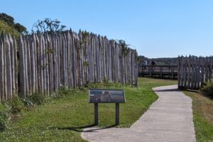
Along the highway you will see long segments of tall wooden fences, standing at an angle to the roadway.


Their purpose is to divert blowing and drifting snow away from the road. In the winter, drifts as high as 10 feet line the side of the highway. We’ve seen these fences along multiple roads on our trip so are glad to understand their purpose.

We enjoyed our time in this town. It’s good size and even has a university, but it doesn’t have a Costco, Best Buy, only one standalone Starbucks, and no Great Clips. This description tells us so much about the character of the town.
Leave a Reply
Your email is safe with us.