

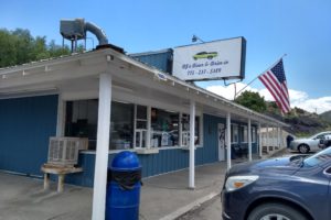
A month or so ago I saw an episode on Fox and Friends about the 100-year centennial celebration of Route 66 in Springfield, Missouri. Since we had already planned to visit some friends in Springfield at the beginning of our trip, we added the Route 66 Museum to our list of activities. Probably like you, Route 66 has been part of our history, especially with the TV show that’s still available to watch on Amazon Prime. A friend joined us on today’s outing. We had met by phone when she helped me with a USAA credit card problem a number of years ago. We had such fun catching up in person. But first we need to add Missouri to our travel map.


Established in 1926, Route 66 stretched 2,448 miles from Chicago to Santa Monica, California.

It served as a vital artery for Dust Bowl migrants and World War II mobilization, before the Interstate Highway System bypassed the route, leading to its official decommissioning in 1985 [more info. at the end of this post]. As severe drought hit the Great Plains, an estimated 210,000 people used Route 66 to travel to California seeking work. Between 1933 and 1938, New Deal programs fully paved the highway, making it the first entirely paved road in the U.S. Author John Steinbeck famously dubbed it the “Mother Road” in his 1939 novel, The Grapes of Wrath. (AI)

The route became a crucial transport corridor to move military equipment and personnel to West Coast defense plants and ports.
Increased military and civilian traffic fueled the growth of roadside diners, gas stations, and motor courts. Following WWII, the booming post-war economy and automobile culture transformed the road into a family vacation route to the Grand Canyon and California. This era birthed the roadside culture of neon signs, Googie-style diners, and the enduring pop-culture song “Route 66.”
(Googie architecture is a futuristic, space-age design style that defined 1950s and 60s America. Characterized by bold neon signs, boomerang shapes, cantilevered roofs, and sweeping glass walls, these restaurants were built to capture the eye of motorists in the post-WWII automobile boom. While classic Googie icons—like Norms and Mel’s Drive-In—are heavily concentrated in Southern California, you can still experience mid-century retro charm near Granite City, Il.)
While finishing this post, we were actually in Granite City, Il., so of course we had to find one of these restaurants! Google told us about to Teri’s Diner, so we went for an early supper and had a great breaded tenderloin sandwiches. Barney liked it too.


“Googie” refers to a Hollywood-based coffee shop called Googie’s, which was built in 1949 by John Edward Lautner, who studied under Frank Lloyd Wright. It became a hangout spot for stars like James Dean, Marilyn Monroe, and Elvis Presley.
The Federal Aid Highway Act of 1956 paved the way for the Interstate system, which incrementally bypassed the winding, two-lane Route 66. By 1984, the last active stretch of Route 66 was bypassed in Arizona. It was officially decommissioned as a federal highway in 1985.
Today, the road is preserved as a cultural icon and tourist destination. Nostalgic travelers can still drive extensive, preserved stretches of “Historic Route 66” across the country. (all from AI)

Springfield is where the official designation of the road number “66” was decided upon and so is the birthplace of Route 66. For more information about Springfield’s role in the road, the website of the history will be interesting to you.
Why the “66” designation? Only highways running from coast to coast could have a “0” in its number (40, 80, 90). All numbers ending in “5” indicate you are traveling North or South. So “0” and “5” weren’t available.
The number 66 was chosen in 1926 by highway officials Cyrus Avery (an Oklahoma entrepreneur known as the “Father of Route 66”) and John Woodruff (a businessman from Springfield, Missouri. They originally wanted the Chicago-to-Los Angeles highway to be designated as Route 60, but that name was already claimed by another route. After federal officials offered them Route 62—which Avery felt sounded like a “second-rate” road—they discovered “66” was unclaimed and decided it had a catchy, memorable ring to it. (AI) We’re so glad they chose this number!
sights along Route 66
The Milk Bottle Grocery, built in 1930, was along the initial Oklahoma City Route 66 segment. The tiny triangular brick building was only 350 square feet, but the owners created this powerful advertising gimmick to draw attention to their business.

Every type of tourist attraction was available for tourists to enjoy as they drove along Route 66. Unlike modern limited access highways, all the sights were right at the edge of the road in those early days of highway travel.


The following Cadillac Ranch was created in 1974 as a tribute to the growing popularity of tailfins on Cadillac auto mobiles. This artful collection displays 10 cars buried front first in the ground, and is a must-see for travelers on Route 66 through Amarillo, Texas.

One business acknowledged the Mother Road with the brand name Phillips 66 Oil Company.


These Burma Shave signs were familiar to me as we traveled around Iowa in my childhood.

Attracting tourists as they traveled west, this business would forever be recognized by the iconic yellow sign with a giant jackrabbit and the simple slogan “Here it is.” (Sounds like some other marketing for businesses we’ve seen in other parts of the U.S.)

Grants, NM, was one of the towns that claimed the title of the Uranium Capital of the world since it was the epicenter of the largest uranium rush in the 1950s and housed 5 major processing mills.
Flagstaff, Az., has the famous nickname “City of Seven Wonders.” Here are these wonders:
- Grand Canyon National Park: A world-famous natural wonder, located about 80 miles (1.5 hours) north of Flagstaff.
- Oak Creek Canyon: A breathtaking, lush gorge renowned for its dramatic red rock formations and swimming spots like Slide Rock State Park.
- Walnut Canyon National Monument: A steep canyon featuring ancient, well-preserved Sinagua cliff dwellings.
- Wupatki National Monument: A fascinating collection of red-rock pueblo ruins constructed by ancestral Native Americans in the 1100s.
- Sunset Crater Volcano National Monument: A striking, 1,000-foot-tall cinder cone volcano with colorful lava trails.

Guests enjoyed classic neon lights reflecting on the pink stucco exterior walls every night.

Standin’ on the Corner Park, a favorite stop on the Mother Road, honors the city’s history and the mega-hit. Barney and I got to stand on this corner years ago but didn’t get a picture of us there.

With scenic views and temperate weather, Route 66 took travelers to the West Coast on what had been Indian trails a century before.


extra information
In the late 1930s, travel on the Mother Road started to have a tremendous change on commerce along the way. New businesses opened, and in some places, brand-new towns opened up to meet the needs of travelers along the highway. Imagine all the gas stations, motels, food stops, and grocery stores that were needed to serve the travelers.

By 1955 when this sign was seen on Missouri’s Route 66, more advanced cars fed a desire for faster travel.

The golden age began to fade in 1956 when President Dwight D. Eisenhower signed the Federal-Aid Highway Act, funding the modern Interstate Highway System. As Interstate 40 and other modern freeways bypassed the slow, winding downtown stretches of Route 66, mom-and-pop businesses lost their customer base. The route was officially decommissioned in 1985, though many historical stretches are preserved today. (AI)
Springfield has a number of others places we wanted to explore as we spent a few days here, so here we go.

Leave a Reply
Your email is safe with us.