When leaving Canada, our first stop was at Calais, Maine, (pronounced “callus” since we’re in the U.S. and not France). Why stop here? When we were driving into Saint John, New Brunswick, we met a couple in the parking lot of the visitors center who told us about a campground close to the most eastern point of the U.S. While the campground was closed for the season by the time we arrived, we did want to see this spot in the U.S. Also, we needed to refill a prescription now that we were back in the States.

first – Calais
Calais is just over the border as we drove into Maine. The first image we saw was the American flag—what a wonderful sight.

My response to the American flag reminded me of another time I traveled outside of the U.S. Many years ago I went to England with a married couple I was friends with. We flew there on British Airways, which was a delightful introduction to the language and “feel” of Britain. After a couple of weeks traveling around the countryside, we boarded a Pan Am flight home, and I heard a “hi!” for the first time in weeks. That “hi” told me I was going home, and it felt so good.
Back to Calais.
Other views of this small border town showed us a quaint downtown area that I wish we had time to explore. But we only have a few days here since our campground is going to be closing right after we leave.
We saw “sarsaparilla” as an English remedy in a reconstructed pharmacy in the Jost House in Sydney, Nova Scotia. Yes, it’s what we got our non-alcoholic drink from during the wild west days.
One of our goals for being in this border town was to get current with the posts while in Canada. Since we didn’t have WiFi at our campground, we found a local Tim Hortons, and I settled in for a couple of days. The drive-thru was busier than inside, so we didn’t feel badly for being there. The staff was so friendly!
campground
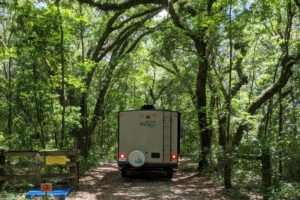
Barney found this lovely campground about 15 minutes outside of town. Keenes Lake Family Campground seems to be a place where families keep their trailers so they can often enjoy being here.


Doesn’t this look like a lovely place to hang out over the summer?
If you ever travel to northeastern Maine, we highly recommend this as a place to camp!
most eastern point of U.S.
We enjoy seeing significant places in the U.S., like the easternmost point here in Maine. On a trip to Florida to see our family there, we took a drive to the Florida Keys and saw the southern most point of the U.S. in Key West.

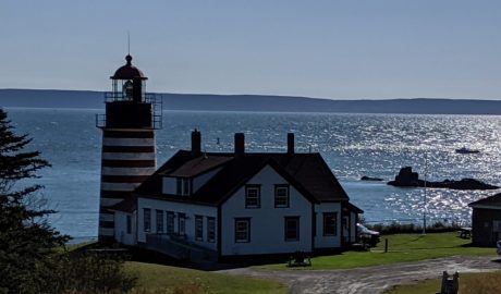
But today we’re at the easternmost point of the U.S. at Quoddy Head State Park.


most eastern town in the U.S.

Here are some view of the town.
This bridge at the wharf of Lubec Narrows that separates Maine from Roosevelt’s Campobello International Park on Campobello Island, which is part of New Brunswick.


45th parallel
We saw a sign for the 45th parallel—-halfway between the Equator and the North Pole—in Nova Scotia, and saw it again between our campground and the town of Lubec.


Today we use GPS technology to “connect the dots” to create these precision maps.

So where else does the 45th parallel run through?

I’m still amazed that this latitude is halfway between the Equator and the North Pole. What other places do you know that are on the 45th parallel that would surprise us?
cranberry bogs
When we turned off the highway to drive to our campground, we kept seeing a sign for a fruit stand selling fresh cranberries. So, when we saw these fields along the road, we figured they were cranberry bogs. We knew that fields were flooded in order to harvest the cranberries, but we didn’t know why. Thanks to the internet, now we know. But first the fields.
Cranberries are found in every New England state, but especially in southeastern Massachusetts. Cranberry plants are actually a group of evergreen dwarf shrubs or trailing vines that can grow and survive only under a very special combination of factors. Each berry has tiny pockets of air that allows it to float to the surface of the water. They can be harvested either in bogs or in flooded fields when bogs aren’t available.
Bogs: Cranberries grow on low-lying vines in beds layered with sand, peat, gravel and clay. These beds are commonly known as bogs or marshes and were originally created by glacial deposits. The bog is flooded with up to 18 inches of water the night before the berries are to be harvested. The growers then use water reels, nicknamed “eggbeaters,” to churn the water and loosen the cranberries from the vine. Each berry has a tiny pockets of air that allows it to float to the surface of the water.
Flooding a field: Flooding is so important in cranberry cultivation that bogs where flooding is not possible are no longer considered profitable. Cranberry growers use flooding as a management tool to protect the plants from the cold, drying winds of winter, to harvest and remove fallen leaves and to control pests.
Now aren’t you glad we found these cranberry bogs? We are!
next stop
What a great time in the most northeastern part of Maine, but now on to another place: LL Bean!


