As we drive through the park today, we’ll be on the lookout for prairie dogs, bison, and wild horses. Wonder what else the park has for us. Bet we’ll see and learn a lot more as we go along!

(We’ll see info on the original entrance later in this post.)
prairie dogs
Once common on the Great Plains, prairie dogs are now almost gone from their historic home. Hunting, trapping, poisoning, disease, and habitat destruction have contribute to their decline.

Since the prairie dogs are protected here in the park, colonies live in various places. They may look cuddly and have curious antics, but these wild animals will scratch, bite, and carry disease. We were encouraged to stay away, and we did. Here are pictures of their homes and their towns.


Their bark-like call earned them their names. The “bark” is just one of many calls they make to each other.
Prairie dogs are plant eaters, getting all their nutrients and water from what’s growing in their towns. They weigh around 1.5 pounds.
The area around the prairie dog town and the prairie beyond are quite different. The plants around the towns are shorter around the burrow mounds.

Some of what lives around the prairie dogs are killdeer, tiger salamander, and burrowing owl.

Tiger salamanders (left) stay in the burrows during the hot, dry days, but come out at night and during rain showers to eat worms and insects.
Burrowing owls (bottom right) lay their eggs and raise their young in abandoned prairie dog burrows. Their diet includes insects and mice.
Little Missouri River

In such an area where water is scarce, the river sustains thousands of animals each day. Trees and shrubs line its banks to provide food and shelter for a variety of wildlife.


beef corrals in bottom areas

Ranchers worked together to round up their free-ranging cattle in the spring and fall. The cattle were then driven to a wide river bottom where they could be worked and sorted.

These staging areas were called “beef corral bottom.” In 1893, a large corral was constructed for the Marquis de Mores’ operation. It held cattle destined for the company’s slaughterhouse in Medora.


Can you imagine how hard it would be for the cowboys to ride through the Badlands, without helicopters or drones, to find all the cattle?
Boicourt overlook
The name probably comes from a spring with that name that’s close by. That name probably came from Albert E. Boicourt (1878-1952) who lived in the SW area of North Dakota (where we are). I couldn’t find any information online about why his name would be used for the springs and the overlook.

Theodore Roosevelt National Park protects only a small part of this vast landscape. The buttes on the horizon are miles away, far outside the park boundary.


Buck Hill prairie
One of the hills along our drive is Buck Hill and the prairie land around it.

The codes underneath the flowers indicate the value of the wild flower: medicinal or eatable for humans; birds; small mammals like mice and rabbits; and grazers like deer, pronghorns, and elk.

purple cornflower: roots of the plant can relieve toothaches
plains pricklypear: fruit is packed with vitamin C; it makes a nutritious snack and can be made into jelly

prairie wild rose: waxy fruits called rose hips are rich in vitamins and can be an emergency food source
sunflower: local agricultural tribes cultivated them for the nutritious seeds.
prairie land over the years
As we’ve learned on this trip, years ago this land was underwater and supported marine life. Then the great glaciers came from the north and froze all that water and underwater life. When the glaciers receded, the land was filled with nutrients.
Then the bison found this land to roam, millions of them flattening the prairie grasses on this land that they found to their liking. Their waste kept being packed down into the land as the herds kept coming. Where they didn’t roam, plants were able to grow tall, depending on how close the grasses were to a water source.
This prairie land is similar to other lands like it over the world. Let’s see what we can learn.

Since the debate over the use or preservation of this land can be so emotional, I wanted to take a closer look at this sign.

Once disturbed, prairie takes decades to recover, but the healing is superficial. The complexity of life that originally created the prairie would take thousands of years and changes to the land to get us to where we had been.

The following picture is from a previous post.

Prairie land is the 2nd most diverse ecosystem in the world after rainforests that have a greater variety of plant and animal life.

I don’t know what your opinion is of the changes to the prairie lands; we can understand both sides. We’re just glad that some of the land still can be seen and that the rest of the land is supporting those who live and farm here to support the rest of us.
Buck Hill info
We had wanted to climb to the top of Buck Hill, but my broken ankle put a nix on that idea. At least we can learn a little about this hill that provides a great view of the Badlands.

The top of the hill is about 2860 feet in elevation, the 2nd highest point in the park. The Badlands stretch out in all directions from this amazing view. Next time we’ll hike up and back.

The hard sandstone that formed at the bottom of the stream now protects the rocks below from erosion. Buck Hill stands firm as surrounding soft sediments below it wash away.

The sign in the forefront of the previous picture gave us even more information about what we’re seeing.


Without the protection from plant cover and plant roots, these slopes erode easily. Rainwater quickly carves away the soft, unprotected sediments.


bison
As promised by the park’s brochure, here are some of the bison we saw on our drive.


I was wary of the one looking straight at us.
an original entrance


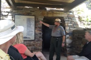
This hike would take us to the historic Old East Entrance Station that looks like it was built by the CCC. The trail passes through a prairie dog town and can be muddy when wet.


As the interstate replaced the original US highway, the park entrance moved to Medora where we were staying.
Badlands overlook


To the Lakota, this land is mako sica, meaning bad land or bad earth. French fur trappers called it les mauvais terres a traverser, meaning the bad lands to cross. Anyone who has been here understands how this place earned its name.


Cliffs, sink holes, coulees, and creeks disrupt the land everywhere we look. These disruptions can turn a short trip into a lengthy ordeal. According to Roosevelt, water is found in “tepid little pools almost dried up,” and are so muddy. He said it could “only be called liquid by courtesy.”


wild horses
As we started driving back, we finally got to see some wild horses!


Now we’re ready to start driving home, but we’ll be seeing a couple of places in South Dakota that I had heard about from my early years living in Iowa.


