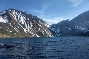
We can’t believe that after this post we’ll have finished with the history of the Pembina area of ND! After leaving the museum, we went for lunch at a small restaurant in a very small town just west of here. This is where I fell and broke bones in my ankle and finger.
Getting ready to say good-bye to Pembina!
But before we say good-bye, we’re going to finish going through Pembina State Museum. Starting with the U.S. military presence here beginning in the time of the Dakota Territory, life changed radically during the 1800s.
the military comes to ND
A number of frontier military posts were established in ND and the upper midwestern region of the U.S. Their purpose? Provide a secure environment for Euroamericans settling here and protect U.S. trading, mining, and transportation interests.
These military posts were all over the upper midwestern region.
And here are the locations of these 39 posts.
Pembina’s military post
The first military installation in the Pembina region was built in the early 1860s. Europamerican settlers feared attacks by hostile Sioux after the 1862 Minnesota uprising. Many of the uprising participants had escaped to Canada and were living just 60 miles north of Pembina.
The settlers sent an urgent appeal to Washington for protection, and a mounted battalion came to protect them.
The 300 Minnesota Volunteers, known as “Hatch’s Battalion” after their commander Major Edward Hatch, were recruited in August and September of 1863 to protect the area.
The men reached Pembina in October and didn’t complete construction of the post buildings until mid-January. After the capture or surrender of about 400 Native Americans involved in the uprising, the post was no longer needed so was abandoned at the end of the 1863-1864 winter season.
Boundary markers like this one were used to mark the boundary of the post.
Military boundary markers like this one designated the land that the military would use for hay to feed their animals and provide areas for maneuvers and armament practice.
U.S.-Canada border and customs
Following the War of 1812, the Treaty of Ghent established the 49th parallel as the boundary between the U.S. and Canada.
This boundary line affected fur trade activities. In 1822, the recently merged Hudson’s Bay/North West Company closed its Pembina posts south of the border, allowing other groups to hunt south of this border.
During the 1820s, the American Fur Company built wintering posts along the border, but the powerful Hudson’s Bay Company stopped their growth by paying them 300 pounds per year to stay away. Free traders (Metis and perhaps others) kept operating in spite the Hudson’s Bay monopoly. The Metis would cross back and forth between the 2 countries with little regard for border formalities.
In 1823, Major Long led an expedition to determine the exact location of the 49th parallel. When he visited Pembina, he reported that the 350 people still living in the area were not a civilized group of people.
The Pembina settlement was found to be within the U.S. territory except for 1 cabin that straddled the border. Major Woods recognized the strategic location of Pembina:
“Pembina is the natural gate through which all intercourse between the U.S. and the Hudson Bay territories will find its passage.”
In 1824, the initial location of the border was called into question, so the parallel was going to be surveyed again. From 1872 to 1873, a 60-man Boundary Commission did their fieldwork to determine the exact location. Amazing that we knew way back then how to survey for the 49th parallel!
Between 1874 and 1875, commissions from the U.S. and Great Britain marked the east/west border from Minnesota to the Rocky Mountains.
Weighing 285 pounds, these hollow, cast iron 8′ tall posts were filled with well-seasoned cedar posts. When set in the ground, they stood 4.5′ high and appeared at intervals of 1 mile. We’ll see one of these posts at our next stop.
an 8′ tall international boundary marker
left: a boundary cutting through the Turtle Mountains in 1872 (we’ll be going to the Turtle Mountains in a few days) right: U.S. survey station at Lake of the Woods, Minnesota, in 1872. This area is in the tip of northeast Minnesota that bulges into Canada.
left: sappers (men who dug the trenches and erected the dirt and sod mounds) building a boundary mound in 1872 right: the principal reference monument erected in 1872; other markers were erected in relationship to this post
left: the American customs agency in the winter of 1872 right: the Canadian customs agency also in the winter of 1872
Fort Pembina
In 1869, Major Hancock, commander of the Department of the Dakota, recommended a post be established near Pembina. The 2 reasons for providing military protection to the area were danger from the Sioux and the 2 railroads that were being built.
In March 1870, the Dept. of War ordered a post be built on the Red River near the intl. boundary. A site was chosen just south of the Pembina River and about 200 yards west of the Red River at low water.
This location seemed to be a good one because it hadn’t flooded since 1851, and it provided hay, pasture, and trees for lumber.
Military actions here were limited to routine border patrol, investigating a few incidents like the murder of 3 St. Joseph men, and capturing several Fenians (militant Irish-Americans who wanted to force England into granting Ireland home rule.)
The fort reached a maximum garrison strength of 200 men in 1878, but just 13 years later only 23 men were at the post. Its average size during its 24-year history was 125 enlisted men and 8 officers.
The fort was starting to close down in 1891 and a fire in 1895 burned down most of the buildings. Most of the fort’s paperwork was destroyed in the fire. On September 26, 1895, the last detachment of men left the post. Later the property was sold by public auction.
top: officers quarters bottom: U.S. Army ambulance
life on a frontier military post
Life at a frontier military post was basically dull routine. Activities like reveille, fatigue, duty, dress parade, and flag salute filled the days.
Fatigues, or work assignments, included target practice, gardening, policing the post (cleaning up), wood detail, hauling water, guard duty, and border patrol.
Since the days were routine and boring, excessive drinking and desertion were common responses to the drudgery. “Typhoid pneumonia” was the post surgeon’s name for the leading cause of death: drinking and exposure.
In 1875, the post commander tried to curb the number of these deaths by declaring that drunkenness was an “uncommon offense” during the winter months. Right.
items found in the debris left at the fort
This shoemaker’s last, mounted on a pedestal, was used as a form for making or repairing shoes. It’s 9.5″ long, and it’s toe shape is generic so it can be used for the right or left foot since the frontier military quarter master didn’t issue boots for each foot. Needless to say, it fit neither foot comfortably.
This china plate is from the pattern used by Major Thaker for Fort Pembina in 1870-1895.
In winter, soldiers cut large blocks of ice from the river and stored them for the warmer months.
They filled water barrels at the river and hauled them back to the post.
transportation
Red River ox carts were the first large-scale transportation network in the Valley linking Winnipeg with St. Paul, Minnesota via the Red River Valley.
After 1859, steamboats transported goods between Winnipeg and the head of navigation near Fargo. From there, carts took the goods to St. Paul. As railroads expanded into the state in the late 1870s and early 1880s, they began moving the goods and people westward.
The fur trade business and the growth of Hudson’s Bay company operations in the Winnipeg area were initially responsible for developing transportation systems in the valley. After the collapse of the fur trade, the scores of settlers continued the need for reliable and efficient means of travel.
In 1859, the Burbank brothers and Russell Blakely formed the Minnesota Stage Company. As Anson Northrup was putting his steamer on the Red River, the stage company began building roads to transport mail and passengers.
In 1862, regular service was interrupted late in the summer during the Sioux Uprising when a freight coach and wagon train were attacked and goods stolen. Just 2 years later, the stage line was again providing regular service.
a Minnesota stagecoach
In October 1877, the first locomotive and flat cars were carried by Selkirk’s steamer to Winnipeg.
The steamboat industry was a busy and profitable means of transportation carrying tons of freight between Winnipeg and Fargo starting in 1859 and growing steadily through the 1870s.
These steamboat lines worked with Red River carts, stage coach routes, and railroad lines. Thousands of immigrants traveled down the river to Canada and some traveled up the river from Canada to the U.S.
Anson Northrup put the 1st steamboat on the Red River in 1859 for a $2000 prize. Remember we talked about how he earned his money in part 10?
The first steamboat was too small to handle the volume of traffic on the Red River, so in 1862 it was replaced by the International that was 137′ long and could carry 133 tons. Normal Kittson (remember him in parts 9 and 12?) ran the International for the Hudson’s Bay Company starting in 1864.
Steamboating expanded on the Red River when J.J. Hill launched the Selkirk in 1871. By the next year, the 2 boats were under the Kittson’s management, along with the Red River Transportation Line. By 1875, 5 more steamboats were active on the Red River.
inventory of products carried by a steamboat
a huge steering wheel from a steamboat and an early bicycle
settlement and county organization
Pembina County is the oldest organized unit of government in North Dakota. Originally it was part of the Minnesota Territory, but when Minnesota became a state in 1858, the territory west of the Red River returned to unorganized status.
After some back and forth, the new Pembina County was organized on August 12, 1867, with Pembina as its county seat. The 1870 territorial legislature decided to reduce the size of the county, removing the area around St. Joseph (Walhalla), so that it is the size it is today. By popular vote, the county seat was moved to Cavalier in 1911.
Since Pembina was the first Euroamerican settlement in northern Dakota, Pembina County supplied many of the state’s first political and economic leaders.
An Icelandic family brought these rawhide slippers with them to America. They are made in 1 piece with knitted insides. Sure look comfortable.
Nelson Nelson, a Norwegian immigrant, was the first person to file a homestead claim when the U.S. Land Office opened in 1870.
Having arrived just a year earlier, Nelson became a special deputy collector of customs. He was politically active and served in the Dakota territorial legislature where he made a name for himself by fighting against corporate corruption (way back then) and control over farmers. We first saw information about Nelson Nelson as the 1st homesteader in part 10.
In 1891, Earl Babcock discovered clays that were suitable for making cement in the Pembina Hills. Cement way back then. I’m amazed.
The Pembina Portland Cement Mines were built near Concrete, ND. It operated from 1899 to 1919.
Portland cement, a component of concrete, was used in building structures around the world. At the height of production, 500 barrels were turned out per day at this plant.
Precursors to concrete were used for building since before Christ; one example is the Egyptian pyramids. Romans would have used concrete to build their water viaducts.
agriculture today
Explorer Alexander Henry’s records in the late 1700s provide the first documentation about agriculture in the Pembina area. Small plots of potatoes planted at the fur trade posts was a welcome addition to the traders’ diets. (More about Alexander Henry in parts 9 and 10.)
As settlers arrived in the late 1800s and early 1900s, the prairies were plowed under and converted to cropland. Drainage ditches came hand-in-hand with planting of crops.
Wheat is currently the dominant crop in ND and in the Red River Valley. Other crops include barley, dry edible beans, sugar beets, and potatoes.
This picture shows the top 5 crops of Pembina County in 1898.
potatoes
More than 1,050,000 tons of potatoes are produced annually in this area.
a local potato processing plant
Originally Scandinavian, Irish, and German settlers brought their European potato varieties to the American Midwest in the 1850s. However, potatoes are native to the Americas, and this area has been an ideal place to grow them.
Today 3 types of potatoes are grown here—red, white, and russet—along with numerous varieties.
Irrigation isn’t necessary for growing potatoes in the valley soil. Dryland-grown potatoes have higher density and less water than irrigated potatoes. Also, they are less susceptible to fungus and disease.
The Red River Valley is the 3rd largest potato-growing region in the U.S. and is #1 in the nation for the production of chipping potatoes (making potato chips) and seed potatoes.
a potato field
sugar beets
As early as the 1800s, farmers began planning sugar beets here. By 1919 it was a commercial crop, and beets were shipped to a processing plant in Minnesota, about 300 miles away. I hadn’t known that we get sugar from sugar beets; I thought they were just like the red beets I love eating.
In 1926, the valley’s 1st sugar processing factory was built close by in East Grand Forks, Minnesota. In 1948, American Crystal Sugar opened a second plant at Moorhead, Minnesota.
Sugar factories were added in 1965 and 1975 in North Dakota.
In 1973, American Crystal Sugar Company was purchased by sugar beet growers in the Red River Valley. The co-op is owned by 2000 beet growers, and its corporate headquarters are at Moorhead.
left: a girls’ crew working in the sugar beet fields in 1930s right: hauling over 11,000 lbs. of beets on a gravel highway in the 1930s
left: a pitchfork for digging out sugar beets right: a replica of sugar beets (they’re huge!)
Do you know anything about sugar beets? I don’t, so I’m really interested in this next picture.
They were first grown here in the 1880s. Cooling autumn temperatures help them increase their sugar storage so that by harvest time, each root is 16-18% sugar (or about 16 teaspoons). Harvested beets average 2 lbs. in weight.
While its crystals are made in many shapes and forms, all sugar is chemically the same. A sugar beet has more than sugar. Its byproducts after processing are primarily molasses and beet pulp.
Beet molasses is too bitter for kitchen use, but is valued by those making citric acid, monosodium glutamate, yeast, and shoe polish (!). Beet pulp is dried and formed into pellets for use as livestock feed.
a sugar beet field
Migrant workers supply seasonal hand labor in these fields. These thousands of workers each year are a significant labor force in the Red River Valley. Many of them also work in the potato fields in the northern counties of ND.
How beet sugar is made. Can you figure out this chart? I can’t.
Just over 50% of the sugar in the U.S. comes from sugar beets!
business, industry, and defense
Businesses related to international commerce with Canada have also found a home here. Tourism plays a big role since Pembina is so close to the Canadian border.
The Red River Valley is also involved in America’s national defense with U.S. Air Force facilities at Cavalier and Grand Forks (remember the minutemen posts in parts 4 and 5?).
Completed in 1932, this federal building in Pembina housed the U.S. Customs Service, the DOJ’s Immigration and Naturalization Service, and the U.S. Post Office.
Even ethanol is produced in ND.
High-starch crops such as wheat, barley, corn, and potatoes are excellent for making ethanol, a gasoline fuel additive. After these products have been processed for ethanol, the remains are dried into a by-product called Distiller Dried Grain (DDG), a high protein food supplement for dairy cattle and livestock. Nothing is wasted.
The Motor Coach Industries across the road from the museum (part 14) is making tour buses and coaches. The bus sign was designed to give the illusion of a speeding bus, but not speeding too fast.
Pembina today
Today the Red River Valley is primarily an agricultural region. Rich glacial soil, combined with a favorable climate, makes the region perfect for raising the crops that are grown here.
Agricultural businesses include sugar beet and potato processing plants and grain drying facilities.
A number of ethnic groups call this area home. Canadian Father William Sherman calls 2 of these groups Anglo-American and Anglo-Ontarian; primarily they are made up of English, Scottish, and Irish heritages.
Other groups with Canadian and fur trade associates are Metis and French.
The Metis are still a viable ethnic group in this region. While many other groups have Norwegian or German backgrounds, pockets of Bohemians, Icelanders, and Poles can be found.
Are you ready to say good-bye to the Pembina area too? We’re sad to leave but are looking forward to seeing what else is along our way as we travel west along the border with Canada.